
Road transport started with the development of tracks by us and our ‘beasts of burden’. The first forms of road transport were horses and oxen which were used for carrying goods over tracks that often followed game trails for food along routes such as the Natchez Trace, a historic forest trail within the United States of America. That trail extends roughly 440 miles from Nashville, Tennessee to Natchez, Mississippi and links the Cumberland, Tennessee and Mississippi rivers. It was created and used by Native Americans for centuries and later used by early European as well as American explorers, traders and emigrants in the late 18th and early 19th centuries. European Americans founded inns along the Trace to serve food and lodging to travellers, however as travel shifted to steamboats on the Mississippi and other rivers, most of these inns were closed. Today the path is commemorated by a parkway which uses the same name as well as following the approximate path of the Trace. In the Palaeolithic Age, we did not need constructed tracks in open country and the first improved trails would have been at fords, mountain passes and through swamps. The first improvements were made by clearing trees and big stones from the path and as commerce increased, the tracks were often flattened or widened to more easily accommodate human and animal traffic. Some of these dirt tracks were developed into fairly extensive networks, thereby allowing for communications, trade and governance over wider areas. The Incan Empire in South America and the Iroquois Confederation in North America, neither of which had the wheel at that time, are examples of effective use of such paths. The first transportation of goods was made on human backs and heads, but the use of pack animals, including donkeys and horses, was developed during the Neolithic Age. The first vehicle is believed to have been the travois, from the French ‘travail’, a frame for restraining horses.

Travois were probably used in other parts of the world before the invention of the wheel and developed in Eurasia after the first use of bullocks for the pulling of ploughs. In about 5000 BC, sleds were developed which are more difficult to build than travois, but are easier to propel over smooth surfaces. Pack animals, ridden horses and bullocks dragging travois or sleds require wider paths and higher clearances than people on foot and so improved tracks were required. By about 5000 BC, proper roads were developed along ridges in England to avoid crossing rivers and getting bogged down. Travellers have used these ridgeways for a great many years and the Ridgeway National Trail itself follows an ancient path from Overton Hill near Avebury to Streatley. It then follows footpaths and parts of the ancient Icknield Way through the Chiltern Hills to Ivinghoe Beacon in Buckinghamshire. Ridgeways provided a reliable trading route to the Dorset coast and to the Wash in Norfolk as the high and dry ground made travel easy and provided a measure of protection by giving traders a commanding view, warning against potential attacks. During the Iron Age, the local inhabitants took advantage of the high ground by building hill-forts along the Ridgeway to help defend the trading route. Then, following the collapse of Roman authority in Western Europe, the invading Saxon and Viking armies used it. In medieval times and later, the ridgeways found use by drovers, moving their livestock from the West Country and Wales to markets in the Home Counties and London. Before the Enclosure Acts of 1750, or to use the archaic spelling ‘Inclosure Acts, covered the enclosure of open fields and common land in England and Wales, creating legal property rights to land previously held in common. Between 1604 and 1914, over 5,200 individual enclosure acts were passed, affecting just under 11,000 square miles. Before these enclosures in England, a portion of the land was categorised as ‘common’ or ‘waste’ and whilst common land was under the control of the lord of the manor, certain rights on the land such as pasture, pannage or estovers (an allowance of land made to a person out of an estate, or other thing for their support) were held variously by certain nearby properties, or occasionally ’in gross’ by all manorial tenants. ‘Waste’ was land without value as a farm strip, often very narrow areas (typically less than a yard wide) in difficult locations such as cliff edges, or awkwardly shaped manorial borders but also bare rock. Waste was not officially used by anyone, and so was often farmed by landless peasants. The remaining land was organised into a large number of narrow strips, each tenant possessing a number of strips throughout the manor and what might now be termed a single field would have been divided under this system amongst the lord and his tenants, whilst poorer peasants were allowed to live on the strips owned by the lord in return for cultivating his land. The system facilitated common grazing and crop rotation. Once enclosures started, the paths developed through the building of earth banks and the planting of hedges.
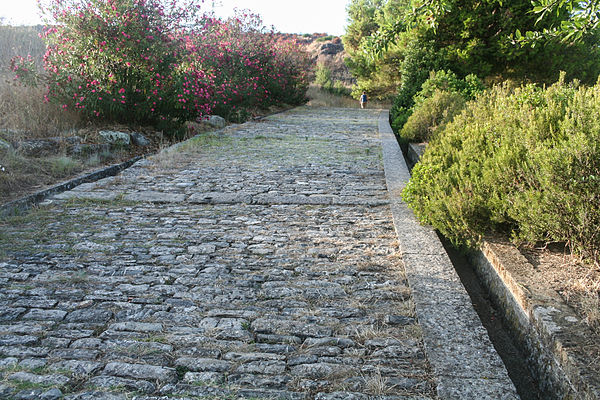
Wheels appear to have been developed in ancient Sumer in Mesopotamia around 5000 BC, perhaps originally for the making of pottery. Their original transport use may have been as attachments to travois or sleds to reduce resistance. Most early wheels appear to have been attached to fixed axles, which would have required regular lubrication by animal fats, vegetable oils or separation by leather to be effective. The first simple two-wheel carts, apparently developed from travois, appear to have been used in Mesopotamia and northern Iran in about 3000 BC and two-wheeled chariots appeared in about 2800 BC. They were hauled by onagers, an Asiatic wild ass related to donkeys. Heavy four-wheeled wagons were then developed about 2500 BC but which were only suitable for oxen-haulage and were therefore only used where crops were cultivated. Two-wheeled chariots with spoked wheels appear to have been developed around 2000 BC by the Andronovo culture in southern Siberia and Central Asia and at much the same time the first primitive harness was invented, enabling horse-drawn haulage. Wheeled-transport created the need for better roads, as natural materials were generally not found to be both soft enough to form well-graded surfaces and strong enough to bear wheeled vehicles, especially when it was wet, and stay intact. In urban areas it became worthwhile to build stone-paved streets and the first paved streets appear to have been built around 4000 BC. Log roads, made by placing logs perpendicular to the direction of the road over a low or swampy areas resulted in an improvement over impassable mud or dirt roads, but rough in the best of conditions and a hazard to horses due to the shifting of loose logs. These log roads were built in Glastonbury in 3300 BC and brick-paved roads were built in the Indus Valley on the Indian subcontinent from around the same time. Then improvements in metallurgy meant that by 2000 BC, stone-cutting tools were generally available in the Middle East and Greece allowing local streets to be paved. In 500 BC Darius the Great started an extensive road system for Persia, including the famous Royal Road which was one of the finest highways of its time and which was used even after Roman times. Because of the road’s superior quality, mail couriers could travel almost 1,700 miles in seven days.

With the advent of the Roman Empire, there was a need for armies to be able to travel quickly from one area to another, and existing roads were often muddy, which greatly delayed the movement of large masses of troops. To solve this problem, the Romans built great roads which used deep roadbeds of crushed stone as an underlying layer to ensure that they kept dry, as the water would flow out from the crushed stone, instead of becoming mud in clay soils. The legions made good time on these roads and some are still used now. On the more heavily travelled routes, there were additional layers that included six sided capstones, or pavers, that reduced the dust and reduced the drag from wheels. These pavers allowed the Roman chariots to travel very quickly, ensuring good communication with the Roman provinces. Farm roads were often paved first towards town, to keep produce clean. Early forms of springs and shock absorbers to reduce the bumps were incorporated in horse-drawn transport, as the original pavers were sometimes not perfectly aligned. But Roman roads deteriorated in medieval Europe because of a lack of resources and skills to maintain them. The alignments are still partially used today though, like on areas of our A1 road. The earliest specifically engineered roads were built during the British Iron Age and the road network was expanded during the Roman occupation. New roads were added in the Middle Ages, from the 17th century onwards and as life slowly developed and became richer, especially with the Renaissance, new roads and bridges began to be built, often based on Roman designs. More and more roads were built, but responsibility for the state of the roads had lain with the local parish since Tudor times. Then in 1656 the parish of Radwell, Hertfordshire petitioned Parliament for help in order to maintain their section of the Great North Road. Parliament passed an act which gave the local justices powers to erect toll-gates on a section of the Great North Road, between Wadesmill in Hertfordshire, Caxton in Cambridgeshire and Stilton in Huntingdonshire for a period of eleven years and the revenues so raised were to be used for the maintenance of the Great North Road in their jurisdictions. The toll-gate erected at Wadesmill became the first effective toll-gate in England. Then came the Turnpike Act in 1707, beginning with a section of the London to Chester road between Fornhill and Stony Stratford. The idea was that the trustees would manage resources from the several parishes through which the highway passed, augment this with tolls from users from outside the parishes and apply the whole to the maintenance of the main highway. This became the pattern for a growing number of highways to have tolls on them and was sought by those who wished to improve the flow of commerce through their part of a county. At the beginning of the 18th century, sections of the main radial roads into London were put under the control of individual turnpike trusts. The pace at which new turnpikes were created picked up in the 1750s as trusts were formed to maintain the cross-routes between the Great Roads radiating from London. Roads leading into some provincial towns, particularly in Western England, were put under single trusts and key roads in Wales were then turnpiked. In South Wales, the roads of complete counties were put under single turnpike trusts in the 1760s. Turnpike trusts grew, such that by 1825 about 1,000 trusts controlled 18,000 miles of road in England and Wales. Interestingly, from the 1750s these Acts required trusts to erect milestones indicating the distance between the main towns on the road. Users of the road were obliged to follow what were to become rules of the road, such as driving on the left and not damaging the road surface. Trusts could also take additional tolls during the summer to pay for watering the road in order to lay the dust thrown up by fast-moving vehicles. Parliament then passed a few general acts dealing with the administration of the trusts along with the restrictions on the width of wheels, as narrow wheels were said to cause a disproportionate amount of damage to the road. Construction of roads improved slowly, initially through the efforts of individual surveyors such as John Metcalf in Yorkshire in the 1760s. British turnpike builders began to realise the importance of selecting clean stones for surfacing, and excluding vegetable material and clay to make better lasting roads. Later, after the ending of the turnpike trusts, roads were funded from taxation and so it was that gradually a proper network of roadways was developed in Britain in order to supplement the use of rivers as a system of transportation and many of these roadways were developed as a result of trading of goods and services, such as wool, sheep, cattle and salt as they helped link together market towns as well as harbours and ports. Other roadways were developed to meet the needs of pilgrims visiting shrines such as Walsingham, even to the transporting of corpses from isolated places to local graveyards. Also during medieval England were built the “Four Highways” and Henry of Huntingdon wrote that the Ermine Street, Fosse Way, Watling Street and Icknield Way were constructed by royal authority. Two new vehicle duties were introduced, the ‘Locomotive duty’ and the ‘Trade Cart duty’ in the 1888 budget and since 1910, the proceeds of road vehicle excise duties have been dedicated to fund the building and maintenance of the road system. From 1920 to 1937, most roads in the United Kingdom were funded from this Road Fund using taxes raised from fuel duty and Vehicle Excise duty but since 1937, roads have been funded from general taxation with all motoring duties, including VAT, being paid directly to the Treasury. Tolls or congestion charges are still used for some major bridges and tunnels, for example the Dartford Crossing has a congestion charge. The M6 Toll road, originally the Birmingham Northern Relief Road, is designed to relieve the M6 through Birmingham as the latter is one of the most heavily used roads in the country. There were two public toll roads, Roydon Road in Stanstead Abbots, Hertfordshire and College Road in Dulwich, London and about five private toll roads. However, since 2006 congestion charging has been in operation in London and Durham. Before 14 December 2018, the M4’s Second Severn Crossing, officially ‘The Prince of Wales Bridge’ included tolls, but after being closed for three days for toll removal the bridge opened up again on 17 December 2018 starting with a formal ceremony and toll payment was scrapped. It made its mark in history as it is believed to be the first time in 400 years that the crossing was free!
After the election of the Labour government in 1997, most existing road schemes were cancelled and problem areas of the road network were then subjected to a range of studies to investigate non-road alternatives. In 1998 it was proposed to transfer parts of the English trunk road network to local councils, retaining central control for the network connecting major population centres, ports, airports, key cross-border links and the Trans-European Road Network. Since then, various governments have continued to implement new schemes to build new roads and widen existing ones as well as review other transport infrastructures because between 1980 and 2005 traffic increased by 80%, whilst road capacity increased by just 10%. Naturally, concern has been raised, especially in terms of damage to the countryside. Also, on 4 June 2018, a change in the law meant that learner drivers, who had previously been banned from driving on motorways, were allowed to use them when accompanied by a driving instructor in a car with dual controls. Because motorway driving is not offered as part of the practical driving test in the United Kingdom, these measures were put in place in an effort to teach motorway safety.
As so often happens when researching a subject such as this, the more one finds it seems the more there is to be found! Suffice to say that in addition to the above there is so much more that can be said about transportation by road, but I think this is enough for now!
This week…
Did you hear about the man who began a career by writing dirty jokes, but then went on to create proper poetry? He went from bawd to verse…
Click: Return to top of page or Index page
